 1. Sunrise at Punta Banda just south of Ensenada.
We are on the Pacific side.
 2. More flowers in green fields give a tranquil look to a troubled sub-division.
 3. The Pacific ocean beach looking out toward Punta Banda
 4. Eating breakfast at the cafe that is part of Adolfo Villarino's RV Park.
 5. Adolfo Villarino in front of the entrance to his RV Park.
at Punta Banda. Aldolfo says "Come to Mexico".
 6. Troy is from Montana. He lives permanently at Adolfo's.
He showed us his "trailer".
 7. Another look at Troy's trailer addition.
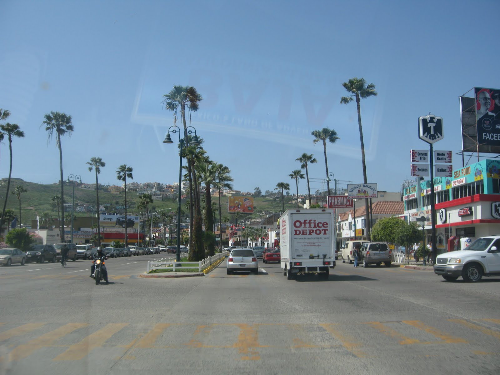 8. Driving down the Malecon in Ensenada. At 1/2 million people,
this is the most traffic we have seen in 5 weeks. We decide NOT to try
crossing the border at Tijuana and opt for Tecate instead.
 9. Crossing the mountains on Hwy 3 to Tecate, we find fields...
 10. ...of yellow flowers ....
 11. With white accents. We really need Jack Huffman to do this right.
 12. Arriving at the border, we find the "fence". The maps are wrong to get
to the border crossing. The road on the Mexican side have been
changed to accommodate the lines of cars.
 13. The US to the left. Mexico to the right.
 14. The line of cars to the barder is about 1/2 mile long.
We wait for a little more than 1 hour.
 15. We score our last tamales from a street vendor as we wait.
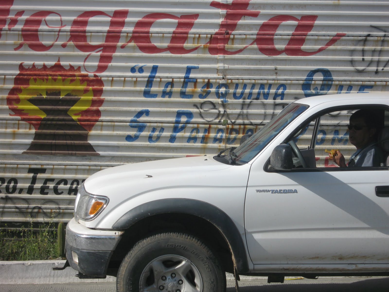 16. The "fence" appears to be free billboard space on the Mexican side of the boarder.
 17. As we creep towrad the border we read one advertisment ...
 18. ... after another ...
 19. Looks like if you buy the taco stand, you get the hot babe in a bikini.
Are our adverts this overt?
 20. ... Wait!!!! Is that for US tax preparations?????
Is that a US phone number???
 21. The competition offers e-file??? What's going on here??
 22. We arrive at the boarder with plenty of time to spare.
 23. Crossing into the USA.
Got up this morning and did the by now normal beach walk. We knew that this would be our last day in Mexico so the feelings were bittersweet. We packed up and drove around Punta Banda. We explored the settlement of houses on the sand spit running toward Ensenada. We talked our way past the security gate and drove to the end of the road and got out and walked the beach. The houses were very up-scale. It was a ghost town. Although the houses looked occupied based on the furniture in the rooms, there did not appear that anyone was in the houses. There was some maintenance going on on several houses. The beaches were empty.
On leaving the spit, we looked for some breakfast and picked the Café outside the RV park we shad stayed at. It belonged to the Villarino R.V. Park and Camping that was immediately next to where we camped. We ordered eggs and sat at the table in front of the café. Adolfo Villarino, the owner of the park, brought out our eggs. It turns out that Adolfo speaks better English than either Ray or me so it gave us an opportunity to ask a lot of questions that had been piuling up during the trip.
We asked Adolfo to sit with us. We discussed the present border politics and narroctics trade. The answer was consistent with what we came to believe is true: the US media is over blowing the situation and the US travelers are staying at home. Oddly, the Canadian travelers seem to keep coming explaining the abundance of British Columbia license plates on the road. The retirees who have been coming to Mexico for years are still there. However, the seasonal traveler, like Ray and me, have all but disappeared. There is drug violence in Mexico for sure. But the question is, are you really going to travel into those areas? If you did, what is the upside of preying on the traveler?
The conversation with Adolfo was refreshing. We discussed Baja history, the local agro-businesses, that affects NAFTA has had on Mexico, and herbal medicines. I would like to post the conversation as it was rich in information, insight, and perspective.
While we were talking with Adolfo, Troy, a welder from Montana, joined us for breakfast. Troy has been living at Adolfo’s camp for two years. He added another perspective to the conversation. Having worked construction management in Las Vegas, he saw first hand the use of illegal labor and the inconsistent policies of various governmental agencies to this practice. The game is played by presenting forge documentation. Interestingly, taxes are collected and withheld against this fake identity. Troy indicated in his experience, it was not a cash business. This led to a number of questions that Troy could not answer. Why can’t the state and federal tax agencies detect these forged identities?
Troy went on to show us his “trailer” complete with permanent addition. Adolfo encouraged us to look at the camp. I had some regrets for not staying there the previous night. It was tidy and clean. He also had hot showers (I had a cold shower that morning). If you are using this as a travel guide, I would definitely recommend Adolfo’s Villarino R.V. Park & Camping as a travel stop between the US and Baja Sur. Here is Adolfo’s contact info:
Villarino R.V. Park & Camping
Punta Banda, Mexico
General Manager: Adolfo Villarino
Kilometer 13 La Bufadora Road Poblado Punta Banda, Baja California Mexico
Phone: 01152 (646) 154-2045, 01152 (646) 154-2034
US Phone: (619) 819-8358
Email: avillar@prodigy.net.mx
If you are interested in sport fishing in the Ensenada area, I would recommend contacting Troy who runs a boat out of Punta Banda.
Troy Dye
“Beater”
Villarino’s RV Park
Punta Banda B.C. MX
(cell) 646.107.4681
(vonage) 406.988.4603
(local) 646.154.3148
Beater57@msn.com
After spending the morning talking, it was clear we needed to move on. We said our goodbyes. Ray went to buy tamales from a stand along the paved road. I went over to the fire station and bought four, tee shirts to support there fund raiser. I had another interesting conversation with the American gentlemen manning the volunteer fire station. I got another perspective on boarder violence and the affects on the local economy.
We drove through Ensenada along the malecon. Traffic was a little crazy and we were glad to clear town.
At El Sauzal, we turned off Hwy 1 onto Hwy 3. We ascended the mountains and came into the wine country which was picturesque. We looking for places to stop but at this point, we really did not have time to stop if we were going to cross the boarder today. We settled for a visual tour. Hwy 3 is a good road. The wine country has easy access from Tecate.
As we neared Tecate, the fields along Hwy 3 were in bloom with yellow flowers.
Arriving in Tecate, we had some unfinished business that involved using up our remaining pesos. We stopped at a super-mercado and bought two bottles of tequila (our legel limit to cross the boarder) and some bananas. We also helped out the Mexican Red Cross who were out fund-raising. The also helped us out with directions to the border crossing. We found the map and GPS to be in disagreement with the road signs. We opted to follow the signs and listen to the Red Cross volunteers. The road has changed to provide room for the queue of cars waiting to cross the border. The road now runs parallel to the fence for over a mile keeping the back-up of cars from spilling into Tecate.
While in line, it became apparent that the “fence” is used as a billboard on the Mexican side posting advertisements for an eclectic mix of goods and services including US tax preparation. We read and photographed many of these adverts. We also scored some tamales from a stand servicing the northbound travelers.
When we finally had our turn with the immigration officer, it was not pleasant. Regardless of what is happening at the border, manners should not become a casualty. Both Ray and I felt that we were treated like we were guilty of something. The was an implied threat in our initial interview “if your story checks out, you will make Joshua Tree tonight, …. If not, you are not going to Joshua Tree”. We went through secondary inspection where the next officer gave us incomplete instructions (e.g. “stand by the table” – there were six tables, none in the bay with our car) then became irritated when we went to the wrong table. In the end, there was no “Thank you” or “Welcome to the US”, on a wave of the hand. I also thought it interesting that I did not recognize and latin workers. I am not trying to slam the customs and immigration people. I recognize that they perform a difficult, at times hazardous, and often unappreciated job. However, I am an US citizen carrying a passport returning from travel in the country of one of our biggest trading partners. We were doing nothing illegal (well .. in the end we forgot to declare the tamales). There is no reason for the reception we received. All could have been conducted in a more polite, business like manner. I could not get away with using the tone the boarder officials use in my profession.
On clearing the border, we took state hwy 94 east. It is worth noting the oak trees which we had not seen south of the boarder. I don’t know why these trees appear to be exclusive to one side of the border. We took highway S1 north, then eat on I-8 where we passed through a border patrol checkpoint. This was remarkably similar to the military checkpoints in Mexico with the exception that they did not check our cooler. We then took state Hwy 79 to Cuyamaca State Park. This was a nice park. The campground was within an oak grove. The park ranger told us that some parasite was killing the oak trees.
We opened the larger of the two bottles of tequila and had supper.
Thursday, 25 March – Bahia de los Angeles, BC to Punta Banda, BC (lat: 31 43.090, long: 116 39.855)
 1. Sunrise at the Bahia de los Angeles
 2. A reminder of where we have been: the coast road to San Felipe.
We briefly consider returning through San Felipe but decide to break
new ground on the Pacific side.
 3. We stop at the ruins of Mission San Fernando about 5 miles off
Hwy 1 and find ourselves on the Comino Real
 4. One of the few historical markers that included English (which was helpful).
 5. Arriving at the cutoff for the Sierra de San Pedro National Park, we see that the
road is washed out. It is a good thing our travel book Spanish has improved
or we would have driven the 50 miles of dirt road to the park.
 6. Beginning around San Quintin, we leave the Sonoran dessert behind.
The land becomes greener. Agro-business extends to Ensenda.
 7. Yellow flowers cover the fields.
This morning we decided that with our one “free” day that we wanted to visit the Sierra de San Pedro Martir National Park. This would take us the high point on the peninsula well above 10,000 feet and promised mountain forest similar to what you find in the Sierra Nevada. This is also the site of the national observatory.
After eating in “town”, we gassed up and left Bahia de los Angeles and had good pavement back to Hwy 1. Once on Hwy 1, it was a long drive through the dessert to El Rossario where we bought gas again. This long stretch across the dessert was broken up only by Catavina which had food (we did not stop) and gasoline being sold out of drums. There was a Pemex station under construction so it looks like there will be better service along this stretch in the future.
We made one stop west of Catavina. At El Progresso, we got off the Hwy and drove about 5 miles to the ruins of the Mission San Fernanado.
Continuing north, we left the Sonoran dessert. We entered an stretch with a lot of agro-business starting around San Quintin and continued north past Vincente Guerrero. There are a lot of people in the area and Hwy 1 is the only road. The road in somewhat congested and isn’t that spectacular to drive.
When we arrived at the turnoff to San Pedro Martir, we saw the sign for the national park. We also saw a sign that said the road was closed because of washouts. Luckily, our travel book Spanish had improved enough to understand this road sign. This part of Baja had experienced very heavy rains in the last year. The fact that several bridges on Hwy had washed out should have been an indication to us that the dirt road through the high mountains was not going to be in good shape either.
We were a little disappointed with this turn of events. We talked about trying it anyway but given that it was getting late we quickly formulated plan “B”. We had talked with a camper at Daggett’s that morning and he had recommended the beaches on Punta Banda south of Ensenada.
We continued north. After passing through Colonet, we passed through some low mountains with extensive vineyards.
We descended into the greater Ensenada area and turned west off Hwy 1 at Maneadero and drove out to Punta Banda. We found an RV park on the beach with (cold) showers and set up camp. We had dinner at “Sharkey’s” restaurant where we had a nice dinner.


